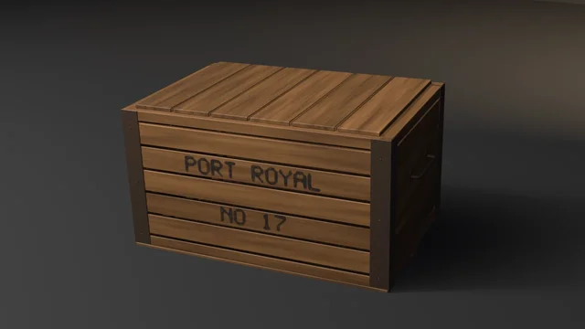
Shipping Crate
A procedural shipping crate through UVs, bake, LOD, collider, and Unity glTF, asserting recomputed budgets rather than an API contract.
showcase/river-delta-tile/
A procedural strategy-game map tile of a river delta — a square 2.40 m on a side, low and flat, where a river comes in through the back edge and forks twice at the angle natural deltas grow toward into four distributaries, each child's width set by hydraulic geometry so the widths squared balance at every fork; its water falling along every channel and level with the sea through the backwater reach to every mouth; natural levees holding each channel over the marsh; a farmed upper plain in a hedged patchwork of staggered fields drilled in rows, a wild lower plain of marsh, salt marsh and mud with an oxbow lake and ponds; a lobed coast with soft tan silt plumes fading into a sea whose colour ramps smoothly with depth out to a slate quay wall, and arrowhead marsh-crowned bars off the mouths; reed beds, weeping willows and poplars, drift logs afloat and stranded up the beaches, and a fisherman's stilt hut with its jetty, boat and a V-shaped wattle fish weir — through UVs, bake, LOD, collider, and Unity glTF, asserting recomputed budgets rather than an API contract.
Rendered headless by the showcase piece itself. Select it to enlarge.
category Terrain
blender --background --python showcase/river-delta-tile/river_delta_tile.py --
A showcase piece, not an example, in the terrain category. It builds a procedural strategy-game map tile at hero-diorama density (about 140k triangles at LOD0; the gated LOD2, about 31k, is the in-game asset): a square 2.40 m on a side, low and flat, where a river comes in through the back edge and splits twice into four distributaries that fan out across a delta plain to the sea at the front. The sea fills the tile out to its rim on the front and both sides.
Every seeded draw comes from random.Random(SEED) in plan_scene(), before anything is built: where each tree, reed clump, log and the hut stand and their size, tone and turn, and the ripple's phases. The ground and the water are closed-form in plan position. No flag draws from the stream, so a falsifier changes only what it names.
All the water — the sea, every channel and each pond — is one slab on the tile's own lattice: a cell holds water when any corner lies under its level, so the sheet's rim runs under the banks, the shore and the rim. Ground never lies within 0.9 mm of the water over it, so the two sheets that share the lattice share no vertex and no plane.
Seven materials: delta ground (marsh, meadow, fields, mud, sand, seabed), water (sea, channels, plumes, ponds), reed (the reeds and the hut's thatch), timber (the hut, jetty, posts, stakes, hurdles, logs and boat), bark, foliage (willows and poplars), tile plinth (the slate rim, its quay wall into the sea, and the skirt's section — a turf line over bedded silts and sands with a scatter of pebbles, as the terrain category's).
It asserts budget conformance of the generated result. It does not witness an API contract. "It rendered without error" is not a check.
Composes skills mesh-editing-and-bmesh, bake-high-to-low, depsgraph-and-evaluated-data, engine-export-presets, and snippets bake_normal_high_to_low.py, setup_bake_target_image.py, lod_chain.py / decimate_to_budget.py, convex_hull_collider.py, export_preset_unity.py (helpers copied inline, not imported).
The collider is eight convex hulls joined in one mesh, built from points only: the plinth up to the water, and the delta's plain in seven fans from the apex, each from where it comes in over the back edge out to the coast or a side. Boats sail the water; units walk the land.
Every budget is declared as a named constant. Every gate recomputes its value from the mesh, materials, UVs, evaluated LOD, collider, or export file.
| Axis | Declared | Measured (5.2.1) |
|---|---|---|
| Base triangles | 138000–142500 | 140062 |
| LOD1 ratio | 0.32–0.62 of base | 0.5000 |
| LOD2 ratio | 0.10–0.35 of base | 0.2200 |
| Materials | exactly 7 distinct; face floors ground ≥51900, water ≥45300, reed ≥16880, timber ≥955, bark ≥627, foliage ≥5257, plinth ≥9560 | 7 slots; 52606 / 46595 / 17414 / 998 / 646 / 5420 / 10752 |
| UVs | in 0..1, AABB overlap ≤ 1e-5 | in range, overlap 0 |
| Outer AABB | (2.4000, 2.4000, 0.2948) m ± 0.01 | (2.4000, 2.4000, 0.2948), zmin 0 |
| Collider tris (eight hulls) | ≤ 360 | 174 |
| Export | written, size > 0, removed after measuring | 14545956 bytes |
DECIMATE COLLAPSE triangle counts are not identical across Blender series, so the LOD gate is a ratio band, not an exact count. Bake pixels are stochastic, so the bake gate is has_data plus operator FINISHED, not byte-identity. The plan is seeded and nothing else is random; two default runs print identical measurements.
The outer AABB's declared height is the tallest poplar's top. Moving the stranded logs off the bars and up the beaches changed how many draws the log loop takes, so the trees and reeds after it were drawn afresh; the declared height follows the new tallest tree (0.2960 to 0.2948 m) at the same ± 0.01 tolerance. No band was widened.
Recomputed from the generated mesh, not asserted about the script.
| Axis | Declared | Measured |
|---|---|---|
| Non-manifold edges | 0 | 0 |
| Loose verts / edges | 0 / 0 | 0 / 0 |
| Doubles merged at 1e-5 | 0 | 0 |
| Zero-area faces | 0 | 0 |
| N-gons | 0 | 0 |
| Coplanar cross-shell face pairs (KD range 0.05 m, plane ε 1e-4) | 0 | 0 |
Grounded: zmin | within 1e-4 of 0 | 0.0000 |
The tile's flat base is the only geometry at Z = 0.
A delta has no joinery. What makes this read as a delta is that its water runs downhill down every channel to the sea, that its forks split the way real ones do, that its levees hold the channels above the marsh, that its islands stand out of the water, and that the reeds, trees, posts and logs are rooted in it or float on it. Each face carries Part, Ident and Cap tags so a shell's role and its foot can be named; every measurement is then made on the shipped mesh by rays straight down onto the water's top and onto the ground, along and across the channels' courses.
| Axis | Declared | Measured |
|---|---|---|
| Water falls: along every mouth's course from the back edge through its forks, the water's surface every 4 mm, the largest rise from one sample to the next | ≤ 1e-6 m | 2e-7 m over 2863 samples |
| Width rule: at each fork, the wetted width across the parent 100 mm upstream and across each child 150 mm downstream, (sum of the children's widths squared) / the parent's squared | 0.88–1.12 | 0.960, 1.008, 0.991 |
| Fork angle: the angle between the two children's courses, each found from the wetted span's middle at 70 and 190 mm | 58–82° | 73.3°, 73.6°, 74.0° |
| Mouths reach the sea: along every course, water over the ground at every sample; the water at its end against the sea's level | no gap, ≥ 0.001 m deep; ≤ 0.002 m | no gap, 0.0034 m shallowest; 0.00000 m at all four |
| Levees: every 25 mm along every channel, each bank's crest (the highest ground out to three crest-distances) over the water at the channel's middle, and over the marsh behind it | ≥ 0.004 m; ≥ 0.0018 m | 0.0078; 0.0021 (228 stations) |
| Islands: the lowest ground over each island's core against the water round it — the sea for the three bars, the higher of the two channels either side for the three islands between forks | ≥ 0.0025 m | 0.0040–0.0050 |
| Water level: the open sea's top, median and largest excursion; each pond's top | level 0.150 ± 0.0015 m; ripple 0.001–0.006 m; ponds flat within 0.0004 m | 0.15000; 0.00240; 0.0000 |
| Water contained: the ground over every rim vertex and rim-edge midpoint of every water sheet (save the river's cut in the back edge) | ≥ 0.0015 m | 0.0025 over 2719 points; 19 at the cut |
| Reeds rooted: every blade's foot (its bottom cap) under the ground | 0.002–0.030 m, 4350 blades | 0.0037–0.0059 |
| Afloat: every floating log and the boat, the share of its height under the water; every stranded log sealed in the ground in each sector | 0.25–0.75; ≥ 0.0025 m | 0.33–0.55 (4); 0.0070–0.0124 (4) |
| Posts: every stilt, jetty post and weir stake, its foot under the bed and its top over the water | foot 0.004–0.050 m, top ≥ 0.003 m over | 0.0099–0.0155 (28); 0.0082 |
| Trees rooted: every trunk's foot under the ground | 0.004–0.050 m, 35 trunks | 0.0094–0.0113 |
Each falsifier violates one named budget. Every one was run on 5.2.1 and exited its declared code.
| Flag | Budget violated | Exit |
|---|---|---|
--skip-decimate | LOD1 ratio band (measured 1.0000) | 9 |
--stray-vert | loose vertex count is 0 (measured 1) | 15 |
--lift-z | bounding box zmin is 0 (measured 0.05000) | 16 |
--uphill-channel | water falls (a 12 mm swell raised mid-course on one channel: rises 0.00046 m between samples) | 17 |
--choke-branch | width rule (one channel narrowed to 0.62 of its width: 0.767 at its fork) | 18 |
--splay-fork | fork angle (one channel swung out 30° about its fork: 104.3°) | 19 |
--plug-mouth | mouths reach the sea (a mouth dammed 6 mm over its water: 5 dry samples along its course) | 20 |
--breach-levee | levees (a crevasse cut in one bank: a crest 0.0015 m under the water) | 21 |
--drown-islet | islands (one bar's crest lowered 10 mm: 0.0055 m under the sea) | 22 |
--flat-sea | water level (the sheet laid flat: ripple 0.00000 m) | 23 |
--short-sea | water contained (the sheet's shoreward rim drawn 50 mm out to sea: −0.0020 m) | 24 |
--float-reeds | reeds rooted (every reed raised 30 mm: feet −0.0263 m) | 25 |
--sink-logs | afloat (the floating logs and the boat sunk 30 mm: 2.7–3.2 of their height under) | 26 |
--lift-hut | posts (the hut, the jetty and the weir raised 30 mm: feet −0.0201 m) | 27 |
--float-trees | trees rooted (the willows raised 40 mm: feet −0.0306 m) | 28 |
--uphill-channel raises the water alone, after the sheet's cells are chosen, so the triangle count holds. --choke-branch, --splay-fork, --plug-mouth, --breach-levee and --drown-islet reshape the ground, so the water covers a few more or fewer cells; the triangle band is wide enough that each reaches its own check. --float-trees lifts the willows only: the poplars stand tallest and would carry the envelope with them.
blender --background --python river_delta_tile.py --
blender --background --python river_delta_tile.py -- --skip-decimate
blender --background --python river_delta_tile.py -- --stray-vert
blender --background --python river_delta_tile.py -- --lift-z
blender --background --python river_delta_tile.py -- --uphill-channel
blender --background --python river_delta_tile.py -- --choke-branch
blender --background --python river_delta_tile.py -- --splay-fork
blender --background --python river_delta_tile.py -- --plug-mouth
blender --background --python river_delta_tile.py -- --breach-levee
blender --background --python river_delta_tile.py -- --drown-islet
blender --background --python river_delta_tile.py -- --flat-sea
blender --background --python river_delta_tile.py -- --short-sea
blender --background --python river_delta_tile.py -- --float-reeds
blender --background --python river_delta_tile.py -- --sink-logs
blender --background --python river_delta_tile.py -- --lift-hut
blender --background --python river_delta_tile.py -- --float-trees
blender --background --python river_delta_tile.py -- --output delta.png
Smoke passes no flags.
The hero does not turn the piece (HERO_YAW_DEG 0) and looks down on the tile from the front, 12° to the left and about 40° over it, the way a map tile is seen on a game board: the river comes in at the back, the forks fan out toward the camera, and the sea, the plumes and the bars lie in front. Seen from this high, the floor behind the tile is the backdrop, so the warm wedge drops its pool on the floor off to the left, where it reaches no water to glare off, rather than on the back wall. Framing measures fill x 0.700, y 0.872, margins left 0.181, right 0.119, bottom 0.061, top 0.067; the asset-quality floors pass.
File-local. 9 is a valid check code. 10 is reserved for gallery_framing.check_framing and 11 for gallery_asset_quality.check_asset_quality, both on the --output path. 15–16 are the hygiene and grounded family; 17–29 are file-local.
| Code | Meaning |
|---|---|
| 0 | Success |
| 1 | Uncaught exception (FATAL wrapper) |
| 2 | argparse / usage |
| 3 | Mesh did not build, no UV layer, or not one tile and its water |
| 4 | Base triangle count outside range |
| 5 | Material count ≠ 7 distinct slots, or a face-count floor missed |
| 6 | UVs outside 0..1 |
| 7 | UV AABB overlap above tolerance |
| 8 | World AABB off declared outer size |
| 9 | LOD ratio band (--skip-decimate lands here) |
| 10 | Framing gate (render path only) |
| 11 | Asset-quality floor (render path only) |
| 12 | Bake did not finish or image has no data |
| 13 | Export file missing or empty |
| 14 | --output produced no file |
| 15 | Mesh hygiene: loose, non-manifold, zero-area, doubles, n-gons, coplanar cross-shell pairs |
| 16 | Not grounded: bounding box zmin off 0 |
| 17 | Water rising somewhere along a channel's course (--uphill-channel) |
| 18 | Width rule: a fork's children's widths squared off their parent's (--choke-branch) |
| 19 | Fork angle: two children's courses outside the band (--splay-fork) |
| 20 | Mouths: a course dry somewhere, or its end off the sea's level (--plug-mouth) |
| 21 | Levees: a crest not over the water, or not over the marsh behind it (--breach-levee) |
| 22 | Islands: an island's core not standing out of the water round it (--drown-islet) |
| 23 | Water: the sea off its level or its ripple outside the band, or a pond not flat (--flat-sea) |
| 24 | Water contained: a sheet's rim not under the ground (--short-sea) |
| 25 | Reeds: a blade's foot out of its band under the ground (--float-reeds) |
| 26 | Afloat: a floating log or the boat out of its draft band, or a stranded log not sealed (--sink-logs) |
| 27 | Posts: a stilt, jetty post or stake's foot out of its band, or its top not over the water (--lift-hut) |
| 28 | Trees: a trunk's foot out of its band under the ground (--float-trees) |
| 29 | Collider triangle count above ceiling |
A procedural shipping crate through UVs, bake, LOD, collider, and Unity glTF, asserting recomputed budgets rather than an API contract.
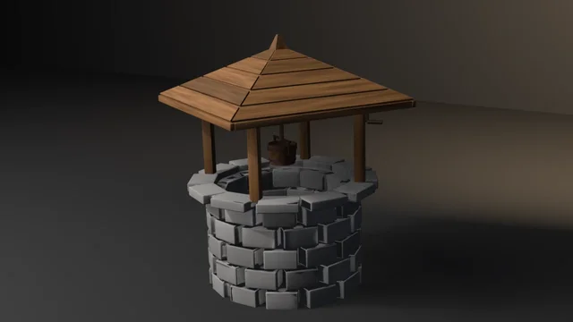
A procedural stone well through UVs, bake, LOD, collider, and Unity glTF, asserting recomputed budgets rather than an API contract.
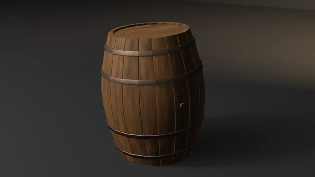
A procedural wine-cask with boarded, croze-seated heads and chord-lofted hoops through UVs, bake, LOD, collider, and Unity glTF, asserting recomputed budgets rather than an API contract.