Actueel Hoogtebestand Nederland (AHN)Environment · unknown
needs-review · commercial ? · unknown
Dutch national height map built from airborne lidar, with raster grids (0.5 m and 5 m) and point clouds, downloadable per map sheet through PDOK. Excellent for flat polder and urban terrain. Marked needs-review: the A…
environmentGeoTIFFLAZ
verified 2026-10-04 (29d ago)
City SampleEnvironment · custom
needs-review · commercial OK · custom
Epic's free sample project showing how the city from The Matrix Awakens: An Unreal Engine 5 Experience was built: a full city with buildings, drivable vehicles and MetaHuman-based crowds, demonstrating World Partition…
environmentUnreal
verified 2026-10-13 (20d ago)
Copernicus DEM GLO-30Environment · custom
active · commercial OK · custom
Radar DSM ~30 m (TanDEM-X / WorldDEM lineage) via CDSE. Full, Free & Open licence for WorldDEM-30: free reproduction, distribution, public communication, and adaptation worldwide. Prefer over FABDEM (NC — high-risk).
environmentGeoTIFFCOGDTED
verified 2026-08-25 (69d ago)
Electric Dreams EnvEnvironment · custom
active · commercial OK · custom UE only
Epic's free sample project from the Electric Dreams demo shown at GDC 2023 alongside Unreal Engine 5.2. It is a jungle environment built from a handful of Quixel Megascans assets and populated with the Procedural Cont…
environmentUnreal
verified 2026-10-13 (20d ago)
ESA WorldCoverEnvironment · CC-BY-4.0
active · commercial OK · CC-BY-4.0
10 m global land-cover maps (2020/2021) + annual Sentinel composites. Good for biome masks, foliage density, and procedural biome painting — not a heightmap.
environmentGeoTIFF
verified 2026-08-24 (70d ago)
ETOPO 2022 (NOAA)Environment · CC0
active · commercial OK · CC0
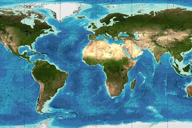
NOAA global relief model integrating topo + bathy (15″ / 30″ / 60″; ice-surface and bedrock). Handy single grid for planet views and tsunami-style water sims. Not for navigation.
environmentGeoTIFFnetCDF
verified 2026-08-24 (70d ago)
active · commercial OK · public-domain
Global ocean + land terrain model (~15″). Best free bathymetry source for undersea levels, coastal games, and planet-scale heightmaps. Not for navigation.
environmentnetCDFGeoTIFFASCII
verified 2026-08-24 (70d ago)
JAXA ALOS World 3D (AW3D30)Environment · custom
active · commercial OK · custom
Global ~30 m DSM from ALOS/PRISM. Free for commercial and non-commercial use under JAXA research-data terms — © JAXA credit required; notify JAXA in advance for commercial use. Optical DEM — cloud/snow voids possible.…
environmentGeoTIFF
verified 2026-07-19 (106d ago)
NASA Deep Star Maps 2020Environment · custom
needs-review · commercial ? · custom
Full-sky star map built from 1.7 billion stars (Hipparcos-2, Tycho-2, Gaia DR2), supplied as linear half-float OpenEXR in plate carree projection from 4k up to 64k wide. A strong source for a space skybox. Marked need…
environmentEXRTIFF
verified 2026-10-04 (29d ago)
active · commercial OK · CC0
~30 m global land DEM reprocessed from SRTM (+ ASTER/AW3D30 void fills). Strong default heightmap for continents when you want clearer voids than raw SRTM. Free Earthdata login for download.
environmentHGTGeoTIFF
verified 2026-08-24 (70d ago)
National Land Survey of Finland Elevation Model 2 mEnvironment · CC-BY-4.0
active · commercial OK · CC-BY-4.0
Finnish national 2 m elevation grid from the National Land Survey (Maanmittauslaitos), released as open data under CC BY 4.0. Good for realistic northern lake, forest and fell terrain at a resolution far above the glo…
environmentGeoTIFFASCII
verified 2026-10-04 (29d ago)
Natural EarthEnvironment · public-domain
active · commercial OK · public-domain
Public-domain vector + raster map data at 1:10m / 1:50m / 1:110m (coastlines, admin, physical). Ideal for stylized world maps, UI globes, and low-detail terrain masks — not high-res heightfields.
environmentshapefileGeoTIFF
verified 2026-08-24 (70d ago)
active · commercial OK · CC0
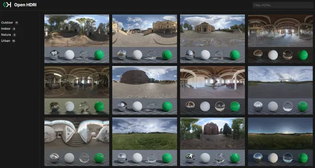
Second CC0 HDRI publisher besides Poly Haven. Real-world captured unclipped linear 32-bit EXRs (library claims up to 29K). Author Grzegorz Wronkowski also runs HDRMaps; this catalog uses the Open HDRI CC0 grant, not a…
environmentEXR
verified 2026-08-29 (65d ago)
OpenStreetMapEnvironment · ODbL
active · commercial OK · ODbL
Global geodata under ODbL. Compiled games are usually “Produced Works” (binary not copylefted); redistributing a modified database can trigger share-alike. Credit OSM contributors. Related converter: OSM2World.
environmentOSMPBF
verified 2026-07-19 (106d ago)
OpenTopographyEnvironment · varies
active · per-file review · varies
NSF-backed portal for lidar point clouds and DEMs (US, global SRTM-class, country-wide 1 m sets). This is the access layer, not one license. Citations page: hosted data are "free of all copyright restrictions" and ava…
environmentGeoTIFFLASLAZ
verified 2026-08-24 (70d ago)
Overture MapsEnvironment · varies
needs-review · commercial ? · varies
Open map dataset (buildings, roads, places, administrative divisions, base land and water, addresses) conflated from many sources. It is convenient for generating city layouts, but there is no single licence: each the…
environmentGeoJSON
verified 2026-10-04 (29d ago)
active · commercial OK · CC0
Photometrically oriented CC0 HDRIs (up to 8K), seamless PBR textures, and environment models. Top safe pick for IBL/sky lighting versus unmoderated aggregators.
environmentEXRHDRPNG
verified 2026-07-19 (106d ago)
swisstopo swissALTI3DEnvironment · custom
active · commercial OK · custom
High-precision bare-earth terrain model of Switzerland at 0.5 m or 2 m grid spacing, delivered in 1 km tiles. Alpine relief at this detail is rare in free data. It falls under swisstopo's open government data (OGD) te…
environmentCOGGeoTIFFASCII
verified 2026-10-04 (29d ago)
USGS EarthExplorerEnvironment · public-domain
active · commercial OK · public-domain
Official USGS/EROS portal for Landsat, SRTM, and other Earth archives. USGS-authored scientific content is U.S. public domain — strong source for SRTM/3DEP-style heightmaps and satellite textures. Expect GIS reproject…
environmentGeoTIFFDEMvarious
verified 2026-08-24 (70d ago)